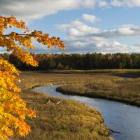
Boardman-ottaway River
Watershed
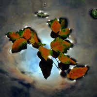
Photo credit: Snap Happy Gal Photography
A river in need of restoration
The Boardman-Ottaway River watershed is in Grand Traverse and Kalkaska counties and includes 180 miles of river and tributary streams. The watershed covers 287 square miles and drains 182,800 acres of land. The Boardman-Ottaway River is a subwatershed of the Grand Traverse Bay watershed, making up almost a third of the land area and tributary inputs of water into Grand Traverse Bay. As such, the Boardman-Ottaway River watershed plays a large role in the ecological health of Grand Traverse Bay.
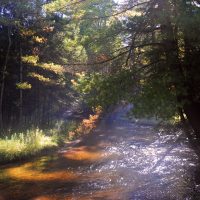
The Boardman-Ottaway River is one of the top ten trout streams in Michigan, with 36 river miles designated as a Blue Ribbon trout stream. Sections of the river are a state-designated Natural River, which afford specific protection for preservation in a natural condition. Historically, the Boardman-Ottaway River was an Arctic grayling fishery, with brook trout, brown trout, and rainbow trout introduced in the 19th and 20th centuries. The river now has self-sustaining populations of brown, brook, and resident rainbow trout as well as migratory rainbow trout and Chinook and coho salmon. The river flows into and through Boardman Lake, which supports typical warm-water game fish populations.
The river is a primary contributor to the quality of life for the surrounding cities and townships. It is a major recreational draw for both residents and visitors, with estimates of as many as two million user days logged on the river annually for recreation purposes. Many of these visitors come to paddle, fish, and hike.
Historically, five dams were located on the Boardman-Ottaway River (Union Street, Sabin, Boardman, Keystone, and Brown Bridge). Currently, only Union Street dam is still in place; Keystone dam washed out in 1961, Brown Bridge dam was removed in 2012, Boardman Dam was removed in 2017, and Sabin Dam was removed in 2018. The recent Boardman River Dams Ecosystem and Restoration Project reconnected over 160 miles of free-flowing, cold-water stream and restored hundreds of acres of wetland and upland habitat.
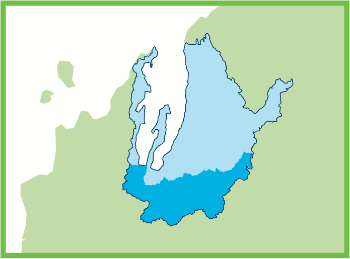

Grand Traverse Bay Watershed
Boardman River Watershed
287
Square Mile Area
180
Miles of River and Streams
Kids Creek Restoration Project
Within the Boardman-Ottaway River watershed, a 4-mile portion of Kids Creek is on the State’s 303(d) Impaired Waters List due to the “other indigenous aquatic life” designated use not being met because of sedimentation and substrate/flow regime alteration related to stormwater inputs. Additionally, Kids Creek is also listed as impaired for “total body contact” due to bacterial contamination from E. coli. In 2013, The Watershed Center worked with EGLE, EPA, and many others to draft and begin implementation of an Action Plan for Kids Creek to address water quality issues and highlight priority tasks aimed at helping improve water quality. This began our large-scale Kids Creek Restoration Project with the goal of reducing the impact of stormwater and sedimentation on Kids Creek and its tributaries so it can be removed from the Impaired Waters List.
Featured Projects:
Kids Creek Restoration
- Kids Creek Road Crossing Improvements
- Kids Creek Chloride Study
- Green Infrastructure at Meijer
- Kids Creek Riparian Restoration
Planning for the future
The Boardman River Watershed Prosperity Plan (brochure) was approved by EGLE and EPA in 2019. In addition to the required watershed plan components, the Prosperity Plan reflects economic and community development needs in the watershed, focuses on its long-term protection, and addresses the issues of business and job creation. The Prosperity Plan states that the Boardman-Ottaway River and its tributaries are largely meeting water quality standards for designated uses, except for Kids Creek. While there have been historical inputs of toxic pollutants and thermal modifications from the dams, the highest priority sources of pollution or other stressors that currently affect or could affect the Boardman River watershed are sediment, nutrients, loss of habitat, and pathogens. Major sources for these priority pollutants include lack of riparian buffers, development (including suburban sprawl), stormwater runoff, aging and failing septic systems, fertilizer use, and livestock in streams.
In 2018, the Traverse City Downtown Development Authority, in cooperation with a community-led Leadership Team, began a process to develop a comprehensive plan for the 1.6 miles of the Boardman-Ottaway River that flows through downtown Traverse City. The Lower Boardman River Unified Plan includes a collective vision for the lower Boardman-Ottaway River and describes the land use policy recommendations, best practices for development, and physical improvement plans for achieving that vision.
With the Boardman River Dams Ecosystem and Restoration Project complete, over three dozen representatives of local organizations and jurisdictions participated in a discussion about what’s next for the Boardman-Ottaway River. This discussion validated the need for a coordinated network of expertise, resources, and leadership to accomplish big things, so the Boardman-Ottaway River Network was formed. This network is dedicated to the preservation, protection, restoration, cultural significance, and sustainable use of the Boardman-Ottaway River and its watershed and acknowledges the significance of the Boardman River Watershed Prosperity Plan.